Exciting developments in the field of augmented reality are underway at the University of Northern Iowa.
Bettina Fabos, a professor of Interactive Digital Studies at UNI is the creator of the Mainstreet 360° project, which received a competitive $150,000 National Endowment for the Humanities grant late this summer. She is also the director of Fortepan Iowa.
“Fortepan Iowa is like a family photo album for the entire state. We aim to help preserve Iowa family snapshots and other local historical photos, and make them accessible to anyone in an interface that is enjoyable and intuitive. We are hoping to help Iowans see that they have played an important role in the history of the state,” she said.
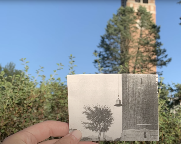
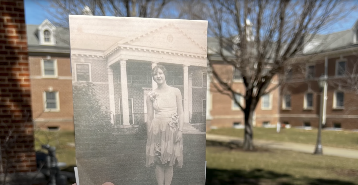
Her newest project, Mainstreet 360°, aims to connect time and place, and tell the story of the UNI campus’ inception and growth through rephotography; the act of shooting an image of the same location during two different time periods, usually to demonstrate change. Fabos was inspired by an application called ‘ForteGO,’ released in 2018 by Fortepan Iowa’s sister site, Fortepan Hungary.
ForteGO users could navigate the city of Budapest through a map which featured historic images of buildings and people that had been matched to the original locations they were taken.
“This app inspired me to talk to John DeGroote, the director of the GeoTREE center on UNI’s campus, about doing something similar for Fortepan Iowa, but for the desktop. The downside of ForteGO is that you have to be physically present and I wanted to see if we could create a virtual reality tool without going to the place itself,” she said.

Another inspiration for the project was Google’s Tour Creator, a program that enabled users to make a VR tour of anywhere in the world, using imagery from Google Street View or their own 360° photos. Fabos also explored the capabilities of this tool with geography professor John DeGroote. Tour Creator was an ideal instrument for educators who were constrained by the confines of the classroom. Students could “visit” any place in the world from the Louvre in Paris, France to the Burj Khalifia in Dubai. Google discontinued the program in June, 2021.
Even though Google has arguably put 360° technology on the map with Google Street View, it does not own this technology. It is imperative that the public is aware that “360° cameras are in reach for everyone,” Fabos says. She intends to spread that message through the Mainstreet 360° workshops she holds for local librarians, who, unlike Google, represent an institution that is not commercially oriented. The work of librarians is to “build experiences that make sense to the public,” she said.
The Mainstreet 360° geolocation team seeks to match photos of UNI buildings from as early as 1903 to their current structures to represent change and growth of the campus over time. Fabos described the back-end process of matching and resizing the original photo to the current-day 360° photo as “like playing a video game.”
This virtual 360° experience will also feature photos of people and traditions that gives the users insight into student life at UNI during different decades. The historical component of the Mainstreet 360° team assists in garnering these photos from resources such as the UNI Special Collections & University Archives. The end goal is to have a three to four-paragraph long blurb about student activities, and the key events and buildings that occurred during each decade at UNI, starting from the 1870s. This work is guided by historian Kristina Poznan, Ph.D. Through image and text, Fabos’ team hopes to construct a comprehensive story of UNI’s growth.
Mainstreet 360° can also be applied in K-12 settings. At the Preserve Iowa Summit in 2021, Fabos heard a presentation from three Spencer, Iowa teachers who coordinated a project with their fourth-graders that involved these students investigating the history of Downtown Spencer and putting together a gallery show to demonstrate what they learned. Though the students were enthused by the project, the teachers were exasperated by the end.
“If they had a tool such as Mainstreet 360°, which allows for the easy display of historical photos overlaid on modern day imagery, the students could have used that, and the teachers would have had a much easier time communicating this history to their students,” Fabos said.
Thus far, the most difficult aspects of the project for the Mainstreet 360° team have been geolocating early images of the UNI campus which feature buildings that have been demolished and make referencing the location of structures difficult. However, Fabos remains optimistic about the process. Her favorite parts of the project have been “working with students, seeing the project reach its potential, and giving presentations and workshops.” With a vast collection of donated photos, Mainstreet 360° will turn its sights to Ottumwa next semester. Fabos anticipates that the Mainstreet 360° prototype will be available in April.


